Subject: Caribbean
Period: 1673 (circa)
Publication:
Color: Hand Color
Size:
10.1 x 7.5 inches
25.7 x 19.1 cm
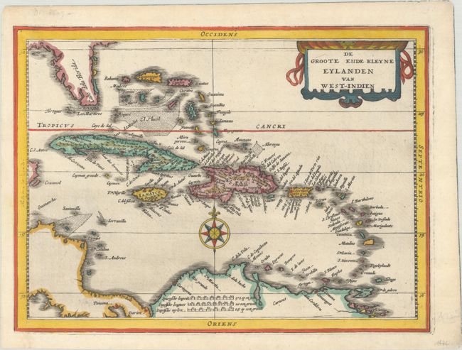
As Mercator did not produce a general map of the West Indies, Cloppenburg drew from the work of Hessel Gerritsz for his edition of the Atlas Minor. The map covers all of the West Indies and the Bahamas and shows the coastlines of the Florida peninsula, Central America, and northern South America. The title is contained in a decorative title cartouche at top right, and the map is further embellished with a compass rose. The wind directions in the border are inaccurate. Most of the maps from this atlas were engraved by Pieter van den Keere, but there is no attribution on this map. Blank verso, published in either Atlas sive Cosmographicae Meditationes (1673) or Nieuwe en Beknopte Uytbeeldinge en Vertooninge der Gantscher Aerdbodem (1676); both of these editions were published by Johannes Janssonius van Waesberghe, Jansson's son-in-law.
References: Van der Krogt (Vol. III) #9600:353.1.
Condition: A
Clean and crisp with one tiny wormhole in the title cartouche.