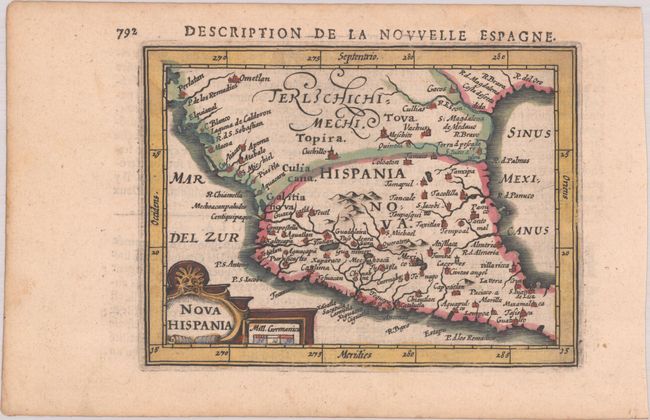
Subject: Mexico & Southern Texas
Period: 1618 (published)
Publication: La Geographie Racourcie de Pierre Bertius
Color: Hand Color
Size:
5.2 x 3.9 inches
13.2 x 9.9 cm
A handsome small map of Mexico and southern Texas, noting numerous rivers and towns, including Mexico City, Guadalajara, and Veracruz (Cruz). The R. de Palmas is approximately where the current border lies between Mexico and Texas, and the R. Escondido is believed to be the Nueces River. Adorned with a decorative cartouche incorporating the distance scale. French text on verso.
See also lot 694 for Geoffrey King's Miniature Antique Maps that describes this map.
References: Burden #186; King (3rd ed.) #1616; Van der Krogt (Vol. III) #9510:342.
Condition: A
A crisp impression in full contemporary color with a faint dampstain in the top blank margin.