Subject: Southwestern United States & Mexico
Period: 1760 (circa)
Publication: Atlas Geographicus Omnes Orbis Terrarum…
Color: Hand Color
Size:
14.4 x 13.7 inches
36.6 x 34.8 cm
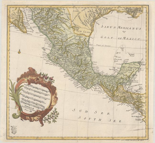
This scarce map is one sheet of von Euler's four-part map of North America. The sheet covers the region from the Gulf Coast of the U.S. through Mexico to Honduras, and presents a detailed view of the Spanish possessions in New Mexico with the note Country Not Particularly Known in Texas. Another note near St. Bernard Bay (Matagorda Bay) notes the settlement Rene-Robert Cavelier, Sieur de La Salle established in 1685. The map stands on its own with a decorative cartouche (containing 6 distance scales) and border. Euler's "cum privilegio" stamp appears at bottom left.
References: Sellers & Van Ee #86.
Condition: B+
A nice impression on a sheet with "Halle" and fancy coat-of-arms watermarks. There are short edge tears and a couple 2" centerfold separations that have been closed with archival tape on verso and a few tiny wormholes at top right. A streak of printer's ink residue appears at bottom right.