Subject: United States & Mexico
Period: 1859 (dated)
Publication: Stieler's Hand-Atlas
Color: Hand Color
Size:
15.8 x 12.6 inches
40.1 x 32 cm
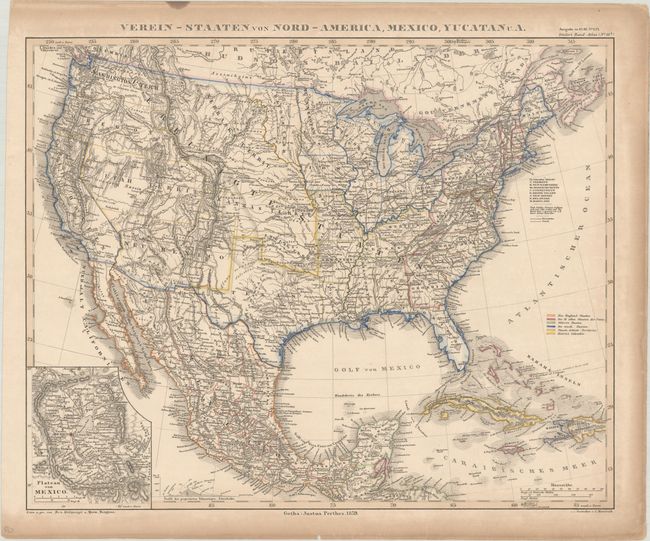
This handsome German atlas map depicts the United States in the lead-up to the Civil War, with slave states highlighted with green borders. There are interesting territorial boundaries in the western US, including Utah Territ., which encompasses present-day Nevada and much of Colorado, and a vast Nebraska Territory that includes parts of North and South Dakota, Montana, and Wyoming. Although it was admitted to the Union as a state the same year this map was published, Oregon appears with its territorial boundaries, with Washington Territory to its north. The Gadsen Purchase is delineated in the southern part of Neu Mexico Territory and labeled Arizona. Minnesota is now a state, with part of its former territory now Dacotah Terr. Kansas is still a territory. An inset details the Plateau von Mexico including the salt marsh of the Texcuco See (Texcoco Lake). Numerous Indian tribes are located throughout the map.
References:
Condition: B+
Contemporary outline color with toning along the sheet edges.