Subject: Utah
Period: 1866 (dated)
Publication:
Color: Hand Color
Size:
18.2 x 25.3 inches
46.2 x 64.3 cm
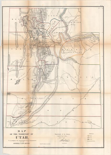
This hand-colored map of Utah Territory was issued in the GLO's annual report for 1866. It locates 17 counties with surveying progress limited to the region around Great Salt Lake and Utah Lake. The map also identifies the proposed route of the Union Pacific Railroad, the Overland Mail Route, Hastings Road, and Captain Simpson's Route. A legend at bottom further identifies gold, iron, and lead deposits. Signed in the plate by Commissioner Joseph S. Wilson. This is one of the scarcer Utah Territory GLO maps and the first in the GLO maps series to employ color.
References: Phillips (Atlases) #1388-18.
Condition: B
Issued folding with contemporary outline color. A number of short fold separations have been closed on verso with old tape, with some resulting staining and toning visible along the fold lines. There is some minor loss at two fold junctions and a few spots of foxing.