Subject: San Antonio, Texas
Period: 1955 (circa)
Publication:
Color: Black & White
Size:
20.6 x 22.1 inches
52.3 x 56.1 cm
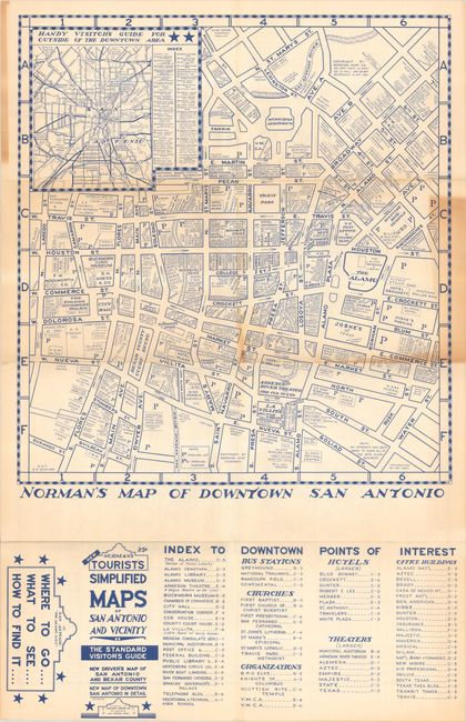
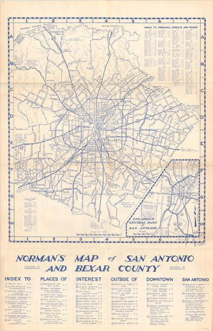
This sheet features large maps of San Antonio printed on both sides in blue ink. One side presents the downtown region with streets named and numerous points of interest located including the Alamo, City Hall, Mexican Consulate, Spanish Governor's Palace, and more. Includes an inset map of the greater region at top left and points of interest below the map. The other side features a highway map of the broader San Antonio region with an inset of downtown at bottom right. Published by Norman Maps Co. We found no past sales records for this map and only one institutional example in the OCLC (Yale).
References:
Condition: B
Issued folding with a couple short splits at the fold junctions. There is light toning along the right border and a few folds.