Subject: Texas
Period: 1925 (circa)
Publication:
Color: Black & White
Size:
17.2 x 11.3 inches
43.7 x 28.7 cm
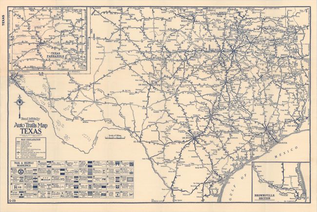
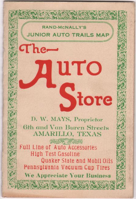
This pocket map of the state was published during the time period that the National Highway System was being developed. It shows a surprisingly developed road network with a legend at left identifying paved roads, improved roads, dirt roads, Texas state highways, trails, and more. Below the legend is a listing of "Trail and Highway Markings" identifying 43 different highway systems shown on the map including the North Texas Highway, Ozark Trails, Old Spanish Trail, The Jim Hogg Highway, Lone Star Trail, and many more. Includes inset maps of the Texas Panhandle and Brownsville in the corners. Folds into paper wrappers (3.2 x 4.9") with an advertisement for "The Auto Store" in Amarillo on the front wrapper.
References:
Condition: A
The folding map is clean, bright and fine. Paper wrappers have minor wear.