Subject: Texas
Period: 1889 (dated)
Publication:
Color: Hand Color
Size:
17.2 x 25.5 inches
43.7 x 64.8 cm
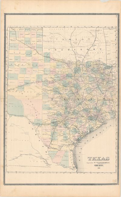
This scarce map of Texas appears identical to the issue by H.R. Page, but does not carry his imprint. County configuration is current to about 1885, with only a few large block counties in the west. Counties are individually hand colored, which is uncommon for an atlas of this era. The western tip of Texas is not included on the main map, but in a bizarre configuration it is drawn upside down below the Rio Grande River, uncolored and virtually invisible, with county development limited to just El Paso and Presidio. The various railroads are named and delineated. The map ocates the cities and towns, watershed and other physical features. The map includes most of Indian Territory (uncolored). Surrounded by a banknote-style decorative border.
References:
Condition: B+
Full contemporary color with light soiling along the edges and a couple short archivally repaired edge tears that enter map image at left. There is a chip in the upper margin, well away from map image.