Subject: South Dakota
Period: 1906 (dated)
Publication:
Color: Printed Color
Size:
18.4 x 12.5 inches
46.7 x 31.8 cm
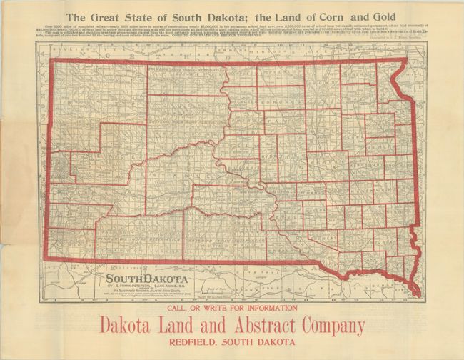
This promotional map of the state was produced by E. Frank Peterson of Lake Andes, South Dakota for the Dakota Land and Abstract Company of Redfield. This all-South Dakota production extolls the virtues and advantages of “the Land of Corn and Gold” with informative text on back summarizing the many economic resources and cultural details for prospective immigrants. The map uses red outline color to delineate counties and Indian Reservations and further identifies towns, railroads, rivers and some topography in the Black Hills region. Folds into paper wrappers (3.3 x 5.9").
References:
Condition: B+
Issued folding with a few short splits at the fold junctions and some minor toning adjacent to the paper wrappers. There is some minor staining in the left blank margin where the map was glued to the rear wrapper. Wrappers are lightly soiled and worn.