Subject: Oklahoma
Period: 1882 (dated)
Publication: New Indexed Commercial Atlas of the Western and Southern States
Color: Hand Color
Size:
20 x 14.4 inches
50.8 x 36.6 cm
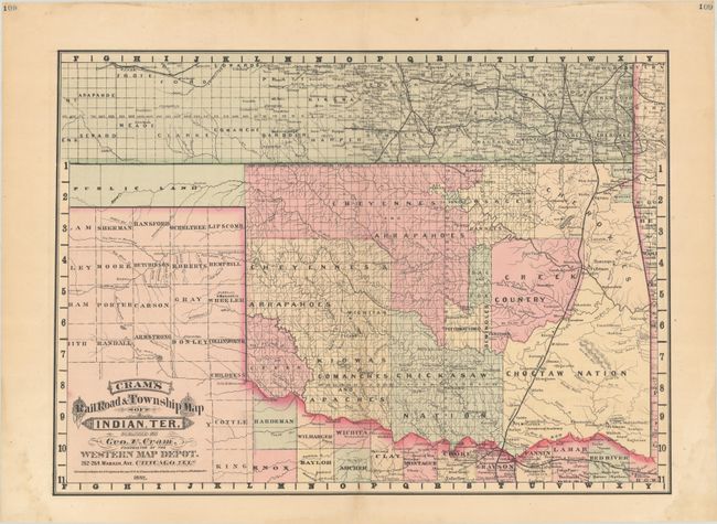
This map details Indian lands designated for the Cherokee, Seminole, Choctaw, Chickasaw, Kiowa, Comanche, Apache, Creek and several other tribes. The Missouri-Kansas-Texas railroad crosses the eastern portion of the territory, passing through Vinita, Gibson Station, McAllister, Atoka and Colbert before crossing the Red River into Texas. The panhandle is Public Lands and parts of Texas and Kansas are shown in detail with full hand coloring. The map is dated 1882 with a copyright date of 1878. The imprint is Cram's Western Map Depot, 262-264 Wasbash, Ave. Chicago Heights. This was one of the last-hand colored maps by Cram, who transitioned to printed color in 1883. A significant and rarely seen map that should be part of any Oklahoma collection.
References: Rumsey #14250.054.
Condition: A
Full contemporary color with light dampstains that are almost entirely confined to the blank margins. A tiny edge tear in the left blank margin has been closed on verso with archival tape.