Subject: New Mexico
Period: 1946 (dated)
Publication:
Color: Printed Color
Size:
16.6 x 21.6 inches
42.2 x 54.9 cm
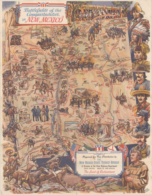
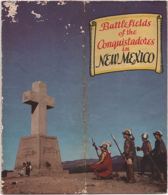
This striking pictorial map of the Land of Enchantment was designed by Tesuque-based artist Wilfred Stedman for the New Mexico State Tourist Bureau. It focuses on the state's military history, spanning from 16th century clashes between the conquistadors and Indigenous peoples to Pancho Villa's raid in 1916. Amidst the historical bloodshed, the map also takes care to showcase the state's many stunning sights, such as Bandelier, the Gila Cliff Dwellings, White Sands, and Carlsbad Caverns. The state is surrounded by an elaborate border of soldiers pursuing Native Americans and a series of historical portraits. Title cartouche includes the flags of the United States, Mexico, New Spain, and the Confederacy. Verso features text on the state's history and a message from Governor John J. Dempsey. Self-folding into brochure (3.9 x 8.5") with a photographic cover.
References:
Condition: B
Issued folding with a few short fold separations, a bit of soiling in the title cartouche, and a small wormhole and a 1" wormtrack to the left of the title cartouche with small loss of image.