Subject: World
Period: 1831 (dated)
Publication:
Color: Hand Color
Size:
29.9 x 19.4 inches
75.9 x 49.3 cm
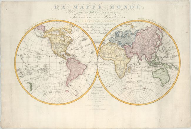
Captain Cook's three voyages are chronicled on this large-scale double hemisphere map. It is precisely engraved and filled with finely rendered detail in both the interior and along coastlines. A legend at bottom provides the dates of the three different voyages, which are well documented throughout the oceans. In the Pacific, New Zealand is shown with both its French title and the original Maori names for each island. In Africa the interior is left largely blank, but the Nile is still shown originating from a lake above the Mountains of the Moon. Cook's observations in Antarctica are detailed including large ice floes. While the map has the appearance of an 18th century map, this edition has been revised and enlarged in 1831.
References:
Condition: A
A crisp impression with full contemporary color. There is one tiny repaired hole above the South Pole in the Western Hemisphere and a few repaired edge tears confined to the far blank margins. Minor soiling is confined to the sheet edges.