Subject: Glacier Park, Montana & Waterton Park, Canada
Period: 1939 (dated)
Publication:
Color: Printed Color
Size:
26.4 x 30.8 inches
67.1 x 78.2 cm
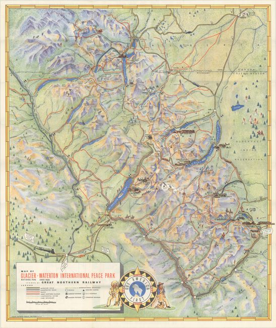
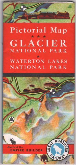
This appealing pictorial map of Glacier National Park was issued by the Great Northern Railway Co. The graphically rendered landscape is peppered with charming illustrations showing hotels, chalets, wild life, and recreational activity. The Great Northern Railway runs along the bottom of the map to the Glacier Park Hotel, a connection that was completed in 1915. In the east, tipis and figures on horseback are depicted in the Blackfeet Indian Reservation. A Mormon temple appears in the northernmost part of the map, in Cardston. The legend in the title cartouche identifies improved and unimproved roads, trails, the Continental Divide, park boundaries, the Canada-United States border, lookout and ranger stations, shelter cabins, and more. The map is further decorated by an ornate compass rose, flanked by a cowboy and an Indigenous man, with a mountain goat and the words, "See America First" at center. On verso are black & white photographs, information for travelers, and a smaller map showing the "Route of the Air-Conditioned Empire Builder" from Chicago to Vancouver. Self-folds into pictorial wrappers (4.0 x 9.0") with alternate title: Pictorial Map Glacier National Park - Waterton Lakes National Park.
References: Rumsey #8867.
Condition: A+
Clean, colorful and fine. Issued folding.