Catalog Archive
Auction 205, Lot 222
Unrecorded Detailed Snapshot of Miami Beach in 1940
"Visitor's Map of Miami Beach from Government Cut to Forty-Fourth Street [on sheet with] Visitor's Map of Downtown Map [on verso] Visitor's Map of Greater Miami"
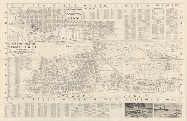
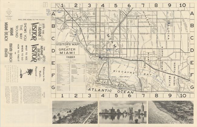
Subject: Miami, Florida
Period: 1940 (circa)
Publication:
Color: Black & White
Size:
32.6 x 17.8 inches
82.8 x 45.2 cm
Download High Resolution Image
(or just click on image to launch the Zoom viewer)
(or just click on image to launch the Zoom viewer)