Subject: Florida
Period: 1838 (dated)
Publication: An Illustrated Atlas, Geographical, Statistical, and Historical, of the United States...
Color: Hand Color
Size:
11.2 x 14.3 inches
28.4 x 36.3 cm
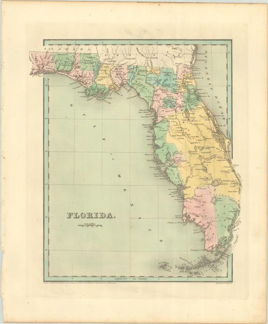
This edition of Bradford's map of Florida was published seven years before statehood. County configuration is current to 1837, just prior to the addition of Calhoun County (1838) in the panhandle. Dade County appears at the southern tip of the state, Hillsborough occupies a large stretch of the Gulf Coast, and a huge Mosquito County dominates the east. Lake Okeechobee (here Lake Macaco) is located with better accuracy, however another lake directly to its north is named Lake Okeechobee. Several Spanish land grants have disappeared, with only Arredondo and Miranda remaining. This map was issued during the height of the Second Seminole War (1835-42), with numerous forts noted throughout and battle sites located in northern Mosquito County. Not to be confused with the more common maps from the Comprehensive Atlas, this sheet is several inches larger and carries much more information. Engraved by G.W. Boynton.
References: Phillips (Atlases) #1381; Ristow pp. 270-271.
Condition: A
Full contemporary color with a few faint spots in the image.