Subject: San Francisco, California
Period: 1946 (dated)
Publication:
Color: Printed Color
Size:
26.4 x 21.4 inches
67.1 x 54.4 cm
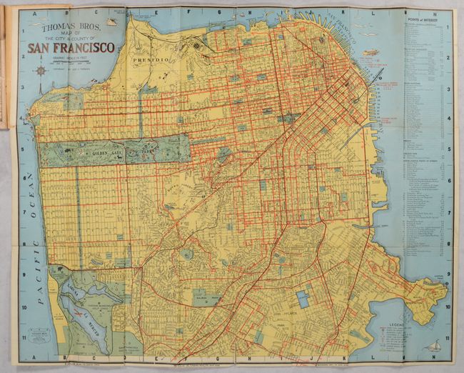
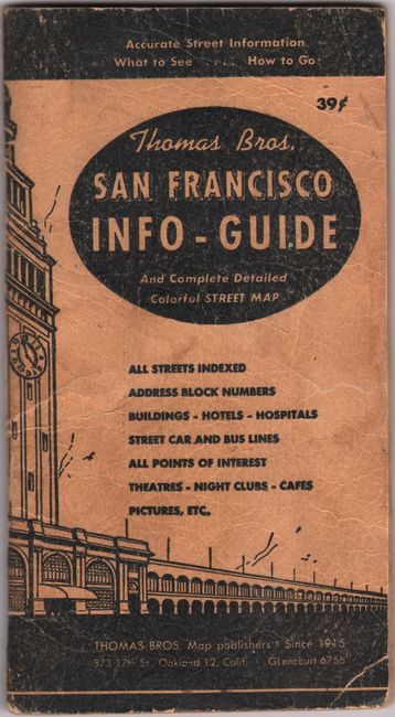
This very detailed plan map of San Francisco appears in a city guide booklet published by the Oakland-based Thomas Bros. The four-color map is credited to George Coupland Thomas. It lays out the city in grid form, with the streets clearly delineated. A list of points of interest at right locates hills and identifies things to see and do in the Civic Center, Golden Gate Park, the Presidio, Lincoln Park, and elsewhere in the city. The legend shows street car, cable, and bus lines, city boundary lines, schools, and parks and playgrounds. Golden Gate Park is a patch of green with little illustrations highlighting recreation in the area. The map folds into the back of a 60-page guide featuring a comprehensive street index, transportation information, and listings for hotels, theaters, cabarets, hospitals, and more. Also included are 4 smaller maps, all in black & white: San Francisco Bay Region, Bay Counties, California and Nevada, and Highways of the Western States.
References: cf. Rumsey #11147.
Condition: B+
Condition grade is for the main map, which is issued folding with a 1.5" fold separations at bottom, a few tiny separations at fold junctions, and light dampstaining at top. The booklet and smaller maps within are lightly toned and moderately dampstained throughout, with light shelf wear to covers. There are blue ink manuscript notations on the San Francisco Bay Region map.