Subject: Northwestern United States
Period: 1876 (dated)
Publication: General Atlas Of The World
Color: Hand Color
Size:
25.4 x 17.4 inches
64.5 x 44.2 cm
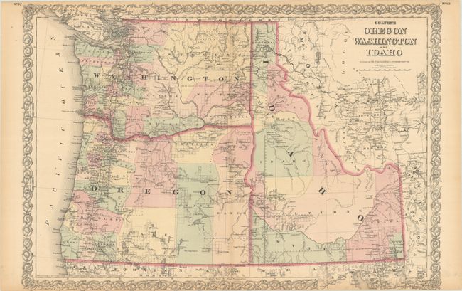
This handsome map of the Northwest extends to Yellowstone National Park with nice topographical detail. The map illustrates the extent of public surveying and locates settlements, Indian reservations, railroads, mining communities, forts, camps, and more. Idaho Territory, established in 1873, is shown here with 11 counties including the large Alturas and Idaho counties. Along the Pacific coast, development has pushed beyond the Cascades with surveying and small communities evident in the eastern portions of both Oregon and Washington. The path of the Northern Pacific Railroad (still under construction) extends from the eastern edge of the map in western Montana to Seattle and Tacoma. Surrounded by Colton's signature strapwork border.
References:
Condition: B+
Full contemporary color with light toning along the centerfold and sheet edges. A few tiny edge tears at top have been closed on verso with archival tape.