Subject: World
Period: 1776 (published)
Publication: Universal Magazine
Color: Black & White
Size:
10.3 x 10.6 inches
26.2 x 26.9 cm
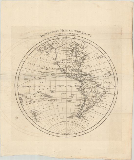
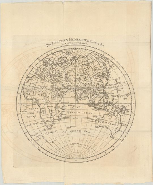
This terrific pair of copper engravings was issued in the May and June 1776 issues of Universal Magazine and present the Western and Eastern Hemispheres in fine detail. The Western Hemisphere map depicts North and South America with the Atlantic and Pacific islands and New Zealand. On this map, the northwest coast of North America is virtually blank and the region of present-day Alaska is a series of islands (Aleutian Islands). A River of the West joins Lake Winnipeg with the Pacific Ocean. In South America, the fictitious L. Parima and L. Xereyes are depicted. The Eastern Hemisphere map covers the countries of the world from Europe to Africa and Asia to Australia, and Tasmania is attached to the Australian mainland.
References: Jolly #UNIV-174 & 175.
Condition: B+
Issued folding on watermarked paper with light offsetting. Two short binding tears are confined to the bottom blank margins.