Subject: Southern United States, Civil War
Period: 1863 (dated)
Publication:
Color: Printed Color
Size:
36.8 x 28.1 inches
93.5 x 71.4 cm
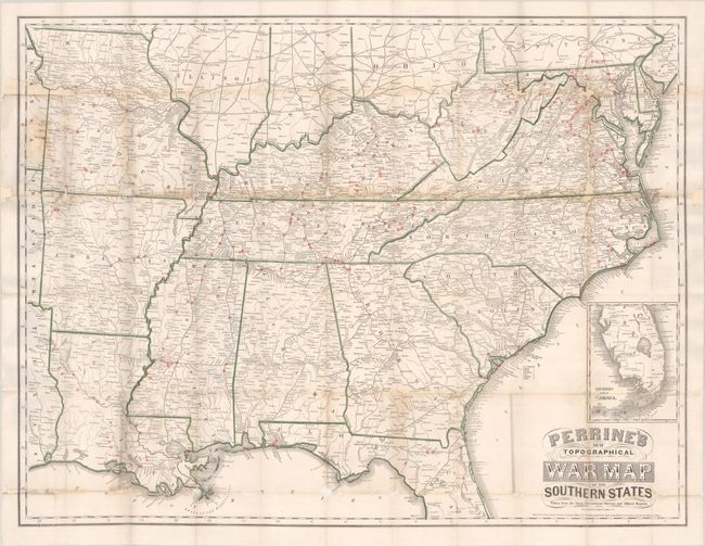
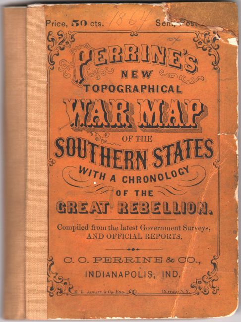
This large folding map of the Southern States is filled with small red circles indicating the sites of major Civil War battles from Pennsylvania to Florida and west to Arkansas and Missori. Roads, railroads, cities, and rivers are also depicted, with an inset of the southern portion of Florida. Engraved by Jewett & Co. The map is accompanied by the original orange boards in which it was issued, which includes the 132-page A Concise History of the War. Designed to Accompany Perrine's New War Map of the Southern States, which was compiled by Captain John S. Bishop. An 11-page Appendix follows the History and gives statistics for the "loyal" and "seceded" states on size, population, military strength, etc.
References:
Condition: B
The map has contemporary color and was issued folding, and has been professionally backed in archival tissue to repair separations and holes along the folds. There is some loss of image due to the holes, which have been repaired with some of the image replaced in facsimile. There is a stain at top left and light toning along several of the folds. The text has very light foxing. The covers are toned and worn with a crease and a chip on the front cover.