Subject: Eastern United States
Period: 1848 (circa)
Publication: A New Universal Atlas...
Color: Hand Color
Size:
12.7 x 16 inches
32.3 x 40.6 cm
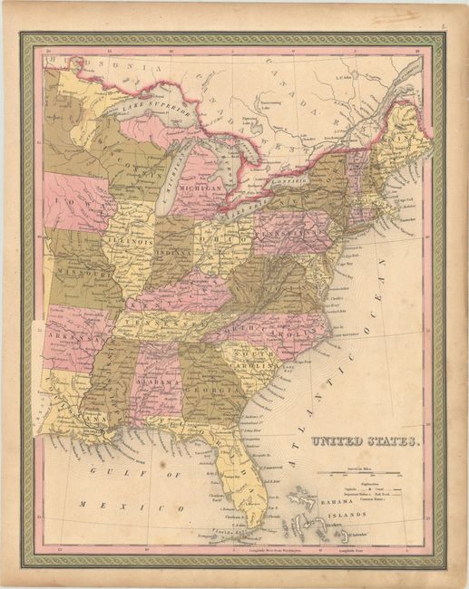
This atlas map of the eastern United States extends west of the Mississippi, all the way to the Texas-Louisiana border. It presents towns and cities, canals, wagon roads and railroads in good detail. Wisconsin is oversized, taking in eastern Minnesota, while Iowa just achieved statehood (1848) and is in its present-day configuration. As a result of Iowa's statehood, western Minnesota is temporarily an unnamed territory until it achieved territory status in 1849. This map was first published by Mitchell in 1846 and updated here to circa 1848.
References:
Condition: B+
Full contemporary color on a lightly toned sheet with minor foxing.