Subject: Colonial Eastern United States
Period: 1755 (dated)
Publication:
Color: Hand Color
Size:
24.3 x 18.9 inches
61.7 x 48 cm
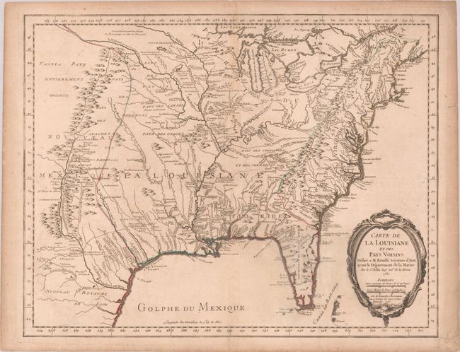
This scarce French and Indian War-era map covers the region from the Great Lakes to Florida, and from the eastern seaboard west to Santa Fe. It was published in Bellin's Atlas Maritime, Remarques sur la carte de l'Amerique Septentrionale, and McCorkle mentions it might have been separately published as well. The cartography is based on Guillaume Delisle's landmark map of 1718, with additional information from French Jesuit historian and traveler Pierre Francois Xavier Charlevoix and other French explorers. It shows the English colonies confined to east of the Appalachians, Spain in control of Florida, and the French in control of the Mississippi River Basin. Several forts are identified, including the destroyed Fort Necessity, site of one of the first battles of the French and Indian War and the only surrender of George Washington's military career. This is the second state, updated to 1755, as indicated in the title cartouche.
References: McCorkle #750.1; Phillips (A) #613-22; Lowery #406; MCC-96 #689; Sellers & Van Ee #18.
Condition: B+
A dark impression with contemporary outline color on a lightly toned sheet with a birdhouse watermark. There is light soiling, some minor extraneous creasing, and a few short tears in the right margin have been archivally repaired.