Subject: United States
Period: 1958 (dated)
Publication:
Color: Printed Color
Size:
35.8 x 30.3 inches
90.9 x 77 cm
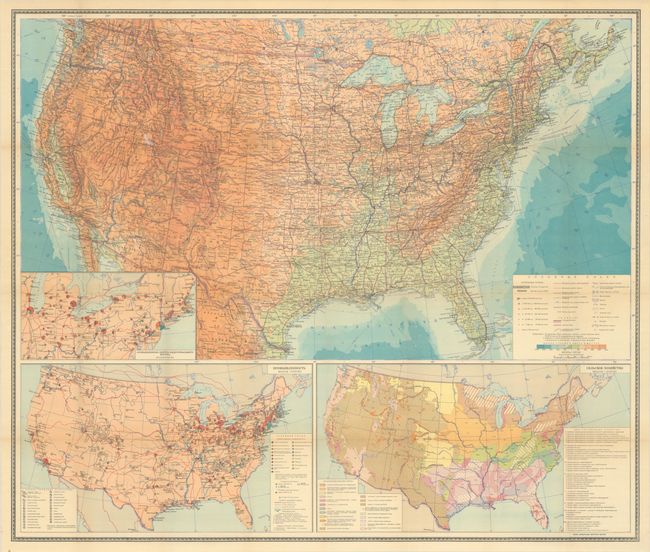
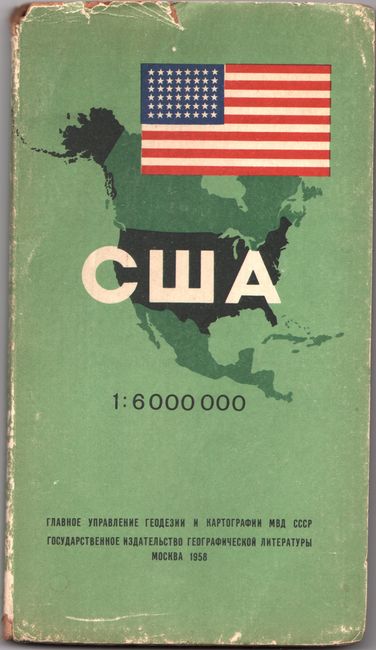
This very detailed Cold War-era Soviet map is vibrantly colored to show elevation, with the higher altitudes in the West presented in various shades of orange. A legend at right reveals substantial information including towns, cities, roads, railroads, canals, as well as some more obscure details including swamps, glaciers, lava fields, and water pipelines. Along the lower portion of the sheet are inset maps illustrating Industry and Agriculture. The map is accompanied by a 52-page brochure featuring the typical gazetteer-type information with propaganda interspersed including references to Lenin, former slave owning states, and the U.S. as a colonial power. The map was produced during a period of high tensions between the U.S. and U.S.S.R. culminating with the Cuban Missile Crisis. Produced by V. Gokhman and V. Kovalevsky and published by The Main Directorate of Geodesy and Cartography of the USSR Ministry of Internal Affairs. Both the map and brochure are laid into stiff paper wrappers (4.7 x 8.5") featuring an illustration of North America and a U.S. flag with 48 stars.
References:
Condition: B+
A colorful example, issued folding, with a hint of pleasant light toning. Accompanying text is mostly clean and bright. The map and text brochure are laid into the covers, which are worn along the edges.