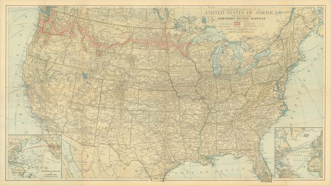
Subject: United States
Period: 1927 (dated)
Publication:
Color: Printed Color
Size:
30.9 x 17.3 inches
78.5 x 43.9 cm
This map of the United States depicts the route of the Northern Pacific Railroad in red. The railroad connects the Great Lakes with Puget Sound. At bottom left is an inset map, Northern Pacific Ry. and Steamship Lines to and from the Orient, emphasizing the Pacific connection. Another inset at bottom right shows routes across the Atlantic. A key identifies double and single tracks of the Northern Pacific, main connections, other railroads, steamship lines, and standard time divisions. Self-folds into pictorial wrappers (4.0 x 9.0") with the alternate title United States Map Showing Direct Freight Routes Seattle Tacoma and Portland to Eastern and Southern Points of U.S.A.
References:
Condition: A
Issued folding with a few tiny separations at fold intersections.