Subject: United States
Period: 1860 (circa)
Publication:
Color: Hand Color
Size:
20.3 x 13.4 inches
51.6 x 34 cm
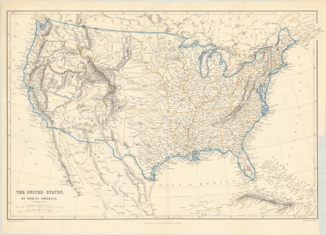
Very precisely engraved map with remarkable territorial boundaries. A large Texas includes today's Oklahoma. Oregon and Washington extend to the Continental Divide. Utah includes present-day Nevada and much of Colorado. New Mexico Territory includes Arizona, the Las Vegas area, and a portion of southern Colorado. A huge Nebraska Territory fills the region between the Rocky Mountains and an enlarged Minnesota. Kansas extends to the eastern boundary of Utah. This interesting map is filled with place names, forts, watershed, and topographical information. Drawn by J.W. Lowry and published in Glasgow, Scotland.
References:
Condition: B+
A crisp impression on a bright sheet, issued folding. There is a binding trim at bottom right with a 2" associated tear that has been repaired with archival tape on verso. A few short edge tears at left and a short tear at center have also been archivally repaired, and there is minor extraneous creasing at bottom and center.