Subject: United States
Period: 1819 (circa)
Publication:
Color: Hand Color
Size:
9.3 x 5.8 inches
23.6 x 14.7 cm
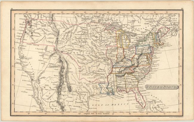
This small map of the evolving United States presents a large Missouri Territory extending to the Pacific Ocean with the Canadian boundary line at the 49th parallel. Mexico is in control of Texas and the Southwest with its northern border established by the Adams-Onis Treaty (1819). Along the west coast two spurious rivers extend into the Great Basin but do not connect to any lakes. In the Midwest, an undelineated Northwest Territory occupies present-day Minnesota and Wisconsin. In the South, Florida is divided between East & West, Mississippi is the "States of Mississippi," but Alabama is still a territory. The map is filled with early towns and settlements, forts, river systems, and topography.
References:
Condition: A
Contemporary outline color with a bit of light toning in the blank margins.