Catalog Archive
Auction 205, Lot 117

"A New Map of Canada, Also the North Parts of New England and New York; with Nova Scotia and Newfound Land. From the Sr. Robert with Improvements", Anon.

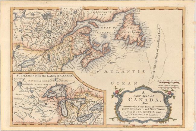
Subject: Colonial Northeastern United States & Canada, Great Lakes

Period: 1766 (circa)

Publication: A New and Complete Dictionary of Trade and Commerce

Color: Hand Color

Size:
11.8 x 8.2 inches
30 x 20.8 cm
Download High Resolution Image
(or just click on image to launch the Zoom viewer)

This is a small, elegantly engraved English version of Didier Robert de Vaugondy's map of 1755 describing the Maritimes and New England. It includes a large inset map of the Great Lakes the course of the Missouri River. Imaginary islands are shown in Lake Superior, including Phalippeaux and Pontchartrain. The map has been updated to reflect the results of the Treaty of Utrecht. Title is contained in a rococo-style cartouche at bottom right. The map appeared in the first volume of Thomas Mortimer's A New and Complete Dictionary of Trade and Commerce.

References: McCorkle #759.3; Kershaw #370.

Condition: A

A nice impression, issued folding, with a tiny wormhole in title cartouche.

Estimate: $275 - $350

Sold for: $200

Closed on 9/10/2025

Archived