Subject: Cape Breton Island, Canada
Period: 1744 (dated)
Publication: Histoire et Description Generale de la Nouvelle France
Color: Black & White
Size:
11.1 x 7.9 inches
28.2 x 20.1 cm
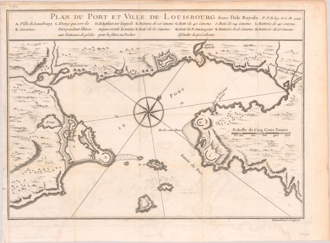
This is the first state of this plan of Louisbourg, the French fortified settlement on Cape Breton Island. War broke out between France and England in 1744, and a large number of maps were produced to describe the areas involved. The French lost Louisbourg to a determined British army, but the treaty of Aix-la-Chappelle returned Louisbourg to the French in 1748. By 1758 Louisbourg was once again besieged by the British, and in 1760 the fortress was leveled. Published only four years prior to its destruction, the plan shows the harbor of Louisbourg in the southeast portion of the island in great detail. A large compass rose topped with a fleur-de-lis in the harbor orients the map with the north to the upper right corner. Engraved by Dheulland.
References: Kershaw #885.
Condition: B+
Issued folding on a watermarked sheet with light offsetting and minor soiling.