Subject: North America
Period: 1859 (dated)
Publication:
Color: Hand Color
Size:
24.8 x 35.6 inches
63 x 90.4 cm
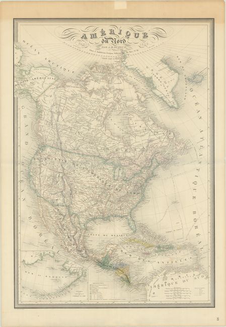
This large, handsome map of North America provides considerably more detail than most continental maps, including state and territory boundaries, towns, roads, forts, Indian tribes, and railroads. The western United States is comprised of the state of California and the large territories of Washington, Oregon, Utah and New Mexico, and the plains region is labeled as the districts of the Mandan and Osage Indians. A large inset map details Alaska and the Aleutian Islands. The map has been color-coded to show ownership and a small legend in the bottom right corner notes shipping routes, railroads and canals. Fancy titling and surrounded by a decorative border.
References:
Condition: B+
Contemporary outline color with light toning in the top blank margin and a few short edge tears also confined to the margins that have been closed on verso with archival tape.