Subject: North America
Period: 1834 (dated)
Publication:
Color: Hand Color
Size:
13.8 x 15.1 inches
35.1 x 38.4 cm
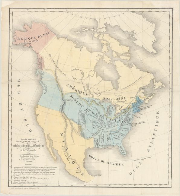
This fascinating French map of the continent accompanied Alexis de Tocqueville's landmark work De la Democratie en Amerique (Democracy in America) (1835-40). De Tocqueville's two-volume study of American democracy, culture, and values is widely recognized as one of the finest and most influential books ever written on America. The map shows population figures for the United States (13 million), British America (1.1 million), Mexico (6.2 million), and Russian America (50,000), as well as the populations and founding years of individual states. Underneath the title, White and Black populations for the non-slave holding states and slave holding states are noted. The United States's claims into British America in the northwest are prominently delineated. A line in what is now central Canada notes the northern extent of corn and grain cultivation and another line denotes the watershed that divides the continent. There are a few other notes, including one west of Arkansas Territory that notes the limits of the grand desert inhabited only by buffaloes, wild horses, and wandering tribes. Lithography by Benard.
References: Howes #T-278; Sabin #96060.
Condition: B
Issued folding, now flat and professionally backed with archival tissue, on a sheet with a "ME" watermark. There is an archivally repaired edge tear that enters 2" into map image and a couple of printer's creases all at left. A chip at top right has been replaced with old paper, with a section of the map border redrawn in facsimile.


