Subject: North America
Period: 1795 (dated)
Publication: The American Atlas
Color: Black & White
Size:
18.4 x 14.4 inches
46.7 x 36.6 cm
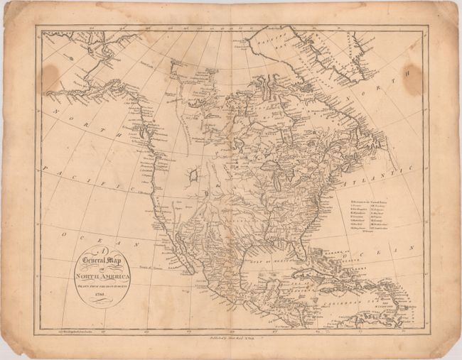
This uncommon map of presents a fine view of the developing cartography of North America. Alaska is still a bit misshapen, but much of the northwest coast is beginning to take shape. Juan de Fonca's Inlet appears in the general vicinity of Seattle and there is no Vancouver Island. Two large, unnamed lakes appear in the otherwise blank western part of the United States, and the Stony Mountains make an early appearance for the Canadian Rockies. The discoveries of Hearne and Mackenzie are shown in the Arctic. The United States are confined east of the Mississippi, where 15 states are identified. Maine is not named and is given a very squat shape. The map was engraved by John Scoles. This is the second state published by John Reid, New York.
References:
Condition: B
A nice impression on paper with the watermarks of "J. Kool" and a Strasburg lily. There is dampstaining at top and along the side borders, light show through from manuscript signature on verso, and short centerfold separations at top and bottom. The bottom corners are chipped, well away from map image.