Subject: South Africa
Period: 1899 (dated)
Publication:
Color: Printed Color
Size:
25.4 x 37.8 inches
64.5 x 96 cm
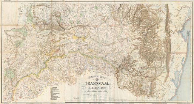
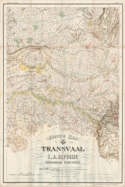
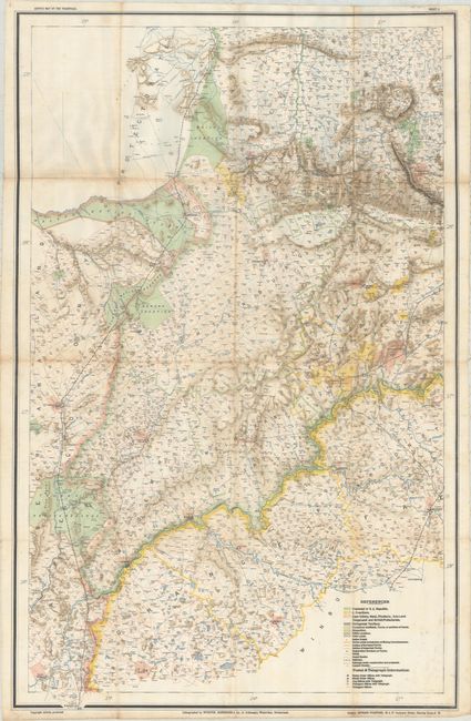
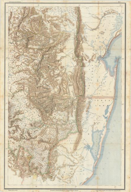
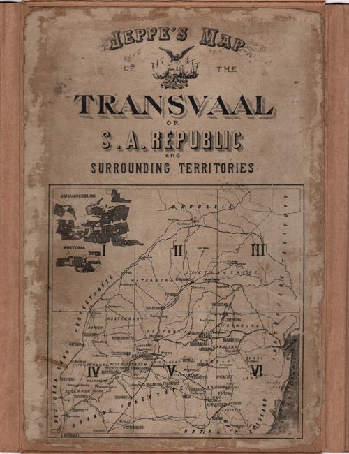
These are the three southern sheets of a six-sheet map of the historic Transvaal Republic within present-day South Africa. Published just prior to the Second Boer War, this map was used by both the British and Boer during the war, as it was the most comprehensive map of the region at the time. The map was compiled by Friedrich Heinrich Jeppe and his son, Carlos Friedrich Wilhelm (Charles) Jeppe, and was based on previous maps, as well as recent sketch inspections and block surveys. Their work on the map began in 1892-93, and the map was originally conceived as just the bottom three sheets (the three sheets in this lot). Friedrich Jeppe, as chief draughtsman for the Office of the Surveyor-General, and in his previous roles within the government of the South African Republic, had numerous connections that enabled him to source updated and reliable data to compile the map. The southern three sheets were completed in 1897, and Friedrich took leave from the Surveyor-General's Office from April to November that year to supervise the preparation of the lithographic plates in Switzerland. During this time, the British were able to secure copies of these three sheets from Switzerland, which aided the British in their war preparation efforts.
As new surveys of regions further north were submitted beginning in 1896, Friedrich realized that he could broaden the scope of the map, and decided to expand it to 6 sheets. Unfortunately, Friedrich became ill in July 1898 and died soon thereafter, prior to the completion of the three northern sheets. Before he passed, the elder Jeppe wrote to Johann Rissik, who had become Surveyor-General in 1895, to request that Rissik assist his son, Charles, in completing the map. The northern three sheets were completed in 1898 and sent to Winterthur, Switzerland, where they were lithographed on waxed silk by Jakob Schlumpf. The map was finally published in full in 1899, just prior to the outbreak of the Second Boer War. Sadly, Charles Jeppe died soon thereafter at the battle of Spion Kopp in January 1900.
These three sheets depict the southern Transvaal from Kimberley and Vryburg in the west to the Indian Ocean, also encompassing Swaziland. The map provides incredible detail not available on previous maps of the region, including farms along with the farm number, kraals, roads, postal routes, postal offices with various services (such as telegraphs and money orders), railroads, and custom houses. Regions are denoted in color, including the Transvaal, Orange Free State, British Protectorate, and Portuguese Territory.
This is a fascinating map that was critical to the Second Boer War and the mapping of South Africa. Printed on three separate sheets and housed in a modern cardstock folder with a ribbon tie and the original index sheet pasted onto the front cover.
References:
Condition: B+
Excellent impressions with bright color, issued folding on waxed linen. There is light soiling and minor dampstaining. The western sheet has a few small holes at two fold intersections at top. The modern cardstock folder is in excellent condition, and the index sheet is soiled with some abrasions and chips along the edges. The first image is a composite image - the map is in 3 separate sheets.