Subject: Western Hemisphere - America
Period: 1816 (circa)
Publication:
Color: Hand Color
Size:
28.8 x 19.3 inches
73.2 x 49 cm
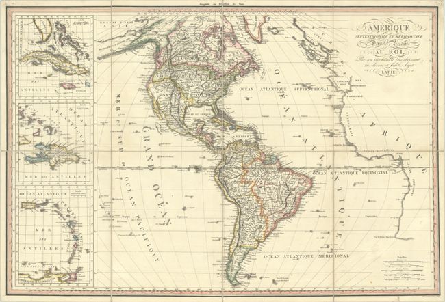
This detailed map of the western hemisphere extends to include the western coastline of Europe and Africa and the northeastern tip of Asia. The United States is shown confined to east of the Mississippi River with a large Louisiana directly to its west which is filled with differnt Indian tribes. Mexico is in control of the Southwest including Texas (which is not named). In the Pacific Northwest, the boundary extends into present-day British Columbia reflecting U.S. interests in the region. The map reflects the discoveries of Lewis & Clark in the Northwest, though to the south a spurious R.S. Felipe still flows from the Great Basin to the Pacific Ocean. At left, three inset maps feature the Caribbean islands. Engraved by D. Veelwaard. The publisher's blind stamp appears below the title.
References:
Condition: A
There are a couple of very faint dampstains at the fold junctions, otherwise fine. Dissected and backed with linen.