Subject: Southeast Asia
Period: 1726 (circa)
Publication:
Color: Hand Color
Size:
16.9 x 12.2 inches
42.9 x 31 cm
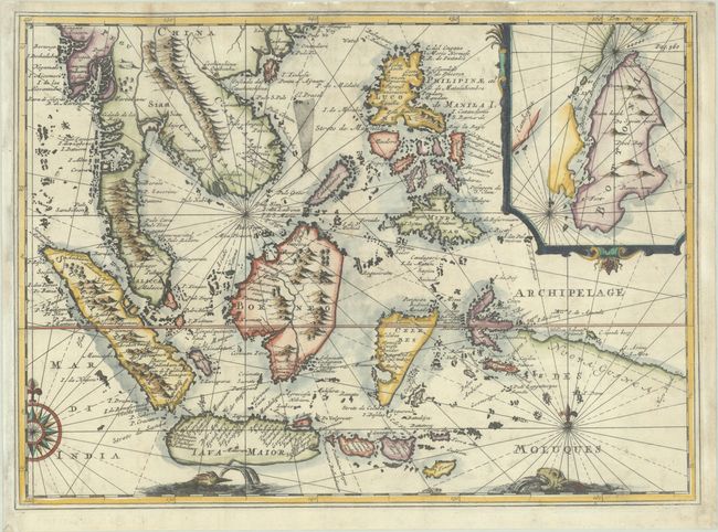
This map is based on Isaac Commelin's map of the region that was published in his compilation of Dutch expeditions in 1646, with a French translation by Rene Augustin Constantin De Renneville in 1725 with newly engraved maps copied from Commelin. This example was likely re-engraved for another account of voyages by De Renneville. Commelin's map was originally based on Theodore de Bry's map of Southeast Asia, maintaining the same location and shape of the islands and land forms and even copying the compass rose and the two sea monsters at bottom. Commelin updated the map by extending it further east to show more of New Guinea, as well as adding an inset of the island of Buton and the Buton Strait in the Celebes. "Pag. 560" and "Tom. Premier page 17“ engraved at top right.
References: cf. Shirley (BL Atlases) G.COMM-3a #36.
Condition: B+
A sharp impression, issued folding on a bright sheet with a "BR" watermark. Professionally remargined at right and left with the neatline at left seamlessly replaced in facsimile.