Subject: World
Period: 1624 (circa)
Publication:
Color: Hand Color
Size:
20.2 x 11.3 inches
51.3 x 28.7 cm
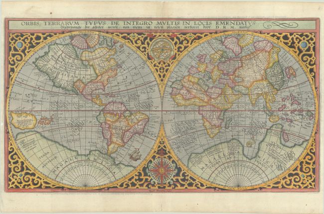
This handsome world map, first issued in 1590, was based on Rumold Mercator's map of 1587. It incorporates the improvements made by Ortelius with a re-shaped South America and inclusion of the Solomon Islands. Plancius introduced new information, based on Portuguese reports, on the far-west coast of America and the western coastline of Africa. Japan is shown for the first time as one small and three larger islands, although still misshapen. It is beautifully engraved in a strapwork surround with a compass rose and armillary sphere tucked between the hemispheres. This example is the third state from a Dutch Bible with the attribution D.R.M. Mathes. Engraved by Baptista Doeticum, with Dutch text on verso.
References: Poortman & Augusteijn #72; Shirley #177.
Condition: A
A dark impression, issued folding on a bright sheet with professional repairs to a couple of short fold separations in the blank margins and to two tears that enter less than 1 cm into the image at left. Narrow side margins, as issued.