Catalog Archive
Auction 204, Lot 541
"Natoliae, quae olim Asia Minor, Nova Descriptio [on sheet with] Aegypti Recentior Descriptio [and] Carthaginis Celeberrimi Sinus Typus", Ortelius, Abraham
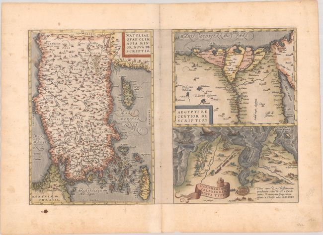
Subject: Eastern Mediterranean, Turkey & Egypt
Period: 1570 (circa)
Publication: Theatrum Orbis Terrarum
Color: Hand Color
Size:
19.3 x 12.6 inches
49 x 32 cm
Download High Resolution Image
(or just click on image to launch the Zoom viewer)
(or just click on image to launch the Zoom viewer)