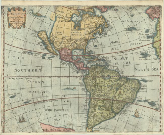
Subject: Western Hemisphere - America
Period: 1652 (dated)
Publication: Cosmographie
Color: Hand Color
Size:
16.6 x 13.3 inches
42.2 x 33.8 cm
Boldly engraved map of the Americas based on the work of Abraham Goos for John Speed. It depicts California as an island with many names and islands surrounding it, no Great Lakes and a faint allusion to the northwest coast of North America. On the east coast, Norumbega, Maryland, No: Belgium, and Long Ile are named. South America has the fictitious Parim and Eupana lakes, as well as dramatic river systems and many place names. The map is decorated with a title cartouche, sea monsters, and sailing ships. This is the first state, dated 1652.
References: Burden #308; McLaughlin #13-3 & 39; Tooley (Amer) p.115, #13.
Condition: B+
A very dark impression, issued folding on a bright sheet with a coat of arms watermark (possibly by P. Mauduit). There is quite a bit of printer's ink residue, but the map is otherwise pristine. Remnants of hinge tape on verso.