Subject: Florence, Italy
Period: 1870 (circa)
Publication:
Color: Hand Color
Size:
20.6 x 15.2 inches
52.3 x 38.6 cm
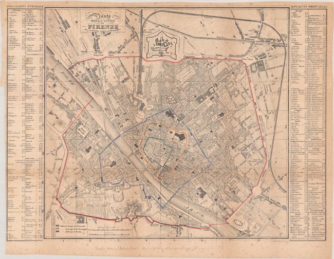
A detailed plan of the fortified city of Florence along the Arno River. The growth of the city's boundaries is demonstrated by outline color from the time of the Romans (green) to Charlemagne (orange), Dante (blue), and then present-day (red). Flanking the plan are two tables with the locations of numerous points of interest keyed to the map. This map was likely issued within a tourist guidebook. Engraved by Luigi Bas--- (?).
References:
Condition: B
Issued folding on thin paper with scattered foxing and light toning along the fold lines. There is a binder's trim at left with a related short archivally repaired binding tear. One small hole near center is only visible when held to light.