Subject: Northern Balkans, Hungary
Period: 1664 (dated)
Publication: Cartes Generales de Toutes les Parties du Monde…
Color: Hand Color
Size:
22.7 x 14.1 inches
57.7 x 35.8 cm
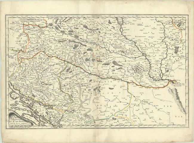
This map presents the southern portion of the Hungarian Empire in the middle of the 17th century. The boundaries extend from present-day southern Hungary in the north to present-day Serbia, Croatia and Bosnia in the south. On the far right side of the sheet, Belgrade is pictured atop a hill at the confluence of the Sava and Danube rivers. The map is filled with hundreds of towns, forests, rivers, and pictorial topography.
References: Pastoureau, SANSON V B [150] & [151].
Condition: B+
A sharp impression with contemporary outline color on a bright sheet with a large coat of arms watermark. There are several light, extraneous creases and some small stains near the center of the sheet. There is marginal soiling and some tiny chips and tears along the edges of the sheet.