Subject: Crimea
Period: 1854 (dated)
Publication:
Color: Hand Color
Size:
15.6 x 12.3 inches
39.6 x 31.2 cm
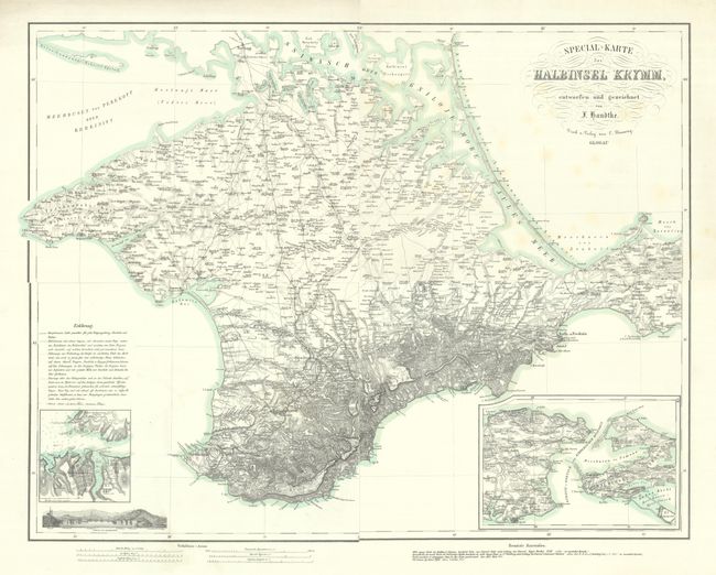
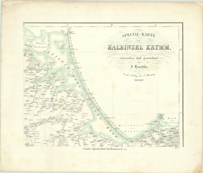
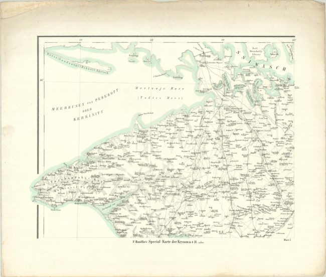
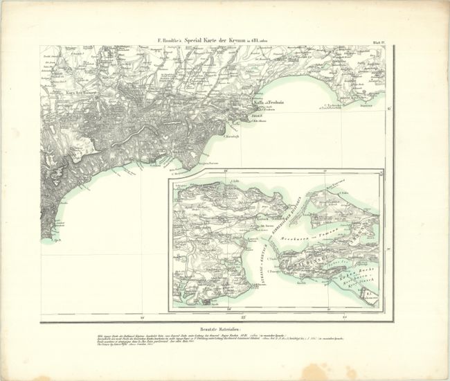
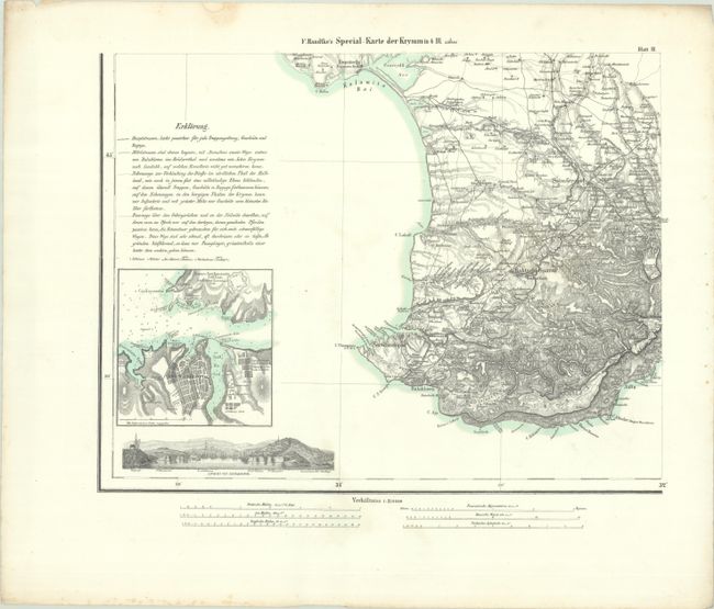
This 4-sheet map covers the main theater of the Crimean War. The Crimean War pitted Russia against an alliance of France, the Ottoman Empire, Britain, and Sardinia in a fight for influence over territories of the declining Ottoman Empire, stemming in part from a conflict between the Russian Orthodox and Roman Catholic churches in the Holy Land. Russia lost the war and, as a result, much of their influence in the region. This map consists of 4 separate sections that when put together measure approximately 30.9 x 24.4". It includes an inset plan of Sevastopol and the surrounding military constructions, as well as a small panoramic view of the city, highlighting the Telegraph Station and the Russian forts Konstantine, St. Nicklas, Alexander, and the Quarantine. Another inset focuses on the Kerch Strait, which connects the Black Sea and the Sea of Azov. On the map there is an explanation of the state of roads and paths and how people, animals, and equipment may move around.
References:
Condition: B+
Sharp impressions with contemporary outline color on bright sheets with marginal soiling. There is light foxing on the top right sheet. The first image is a composite image - the map is in four separate sheets.