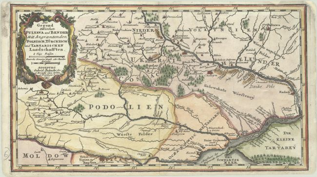
Subject: Ukraine
Period: 1710 (circa)
Publication: Atlas Curieux
Color: Hand Color
Size:
11.9 x 6.7 inches
30.2 x 17 cm
This map depicts southern Ukraine between the Dnister and Dnieper Rivers, focusing on the regions of Podolien (Podolia) and Ukrain Cosackische Laender (Ukraine Cossack Land). Several roads are shown, including the Kumansky Way, the Black (Czarny) Way, and the road that the Tartars used to travel from the Dnieper River to Poland. The site of the Battle of Poltava in 1709 is marked, in which the Russian army defeated the Ukranian Cossacks and the Swedish army. The Cossacks fled to Bender in present-day Moldava, and the following year the Bender Constitution (also known as the Pylyp Orlyk Constitution after its key author) was written, which is often considered as the first constitution of Ukraine.
References:
Condition: B+
A dark impression on a bright sheet, professionally backed in thin, archival tissue to repair several small chips along the edges of the sheet, with a minor amount of the neatline replaced in facsimile. Narrow margins at top and bottom.