Subject: Ukraine
Period: 1680 (published)
Publication: The English Atlas
Color: Hand Color
Size:
19.6 x 15 inches
49.8 x 38.1 cm
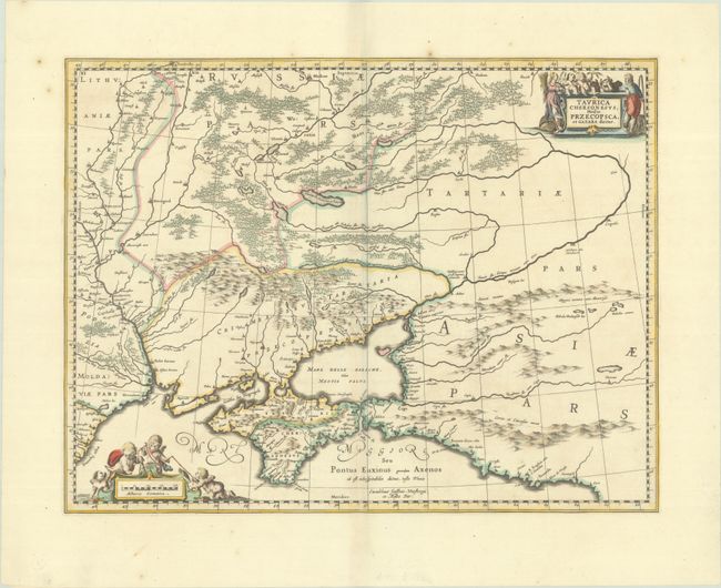
This fine map of the region north of the Black Sea is based on Mercator's cartography. The interior is filled with large forests and mountains. It is embellished with two cartouches surrounded by figures. The plate was originally engraved by Jan Jansson. After his death it was inherited by his son-in-law, known as Jansson-Waesberg, who published it in conjunction with Moses Pitt. This map was published in Volume I of Pitt's The English Atlas, which was initially planned as 12 volumes, but only four volumes were published before Pitt abandoned the project due to debt.
References: Shirley (BL Atlases) T. PITT-1a #11; Van der Krogt (Vol. I) #1890:1B.2.
Condition: A
A crisp impression with full contemporary color on a bright sheet with the watermark of Pieter van der Ley and a few minor spots.