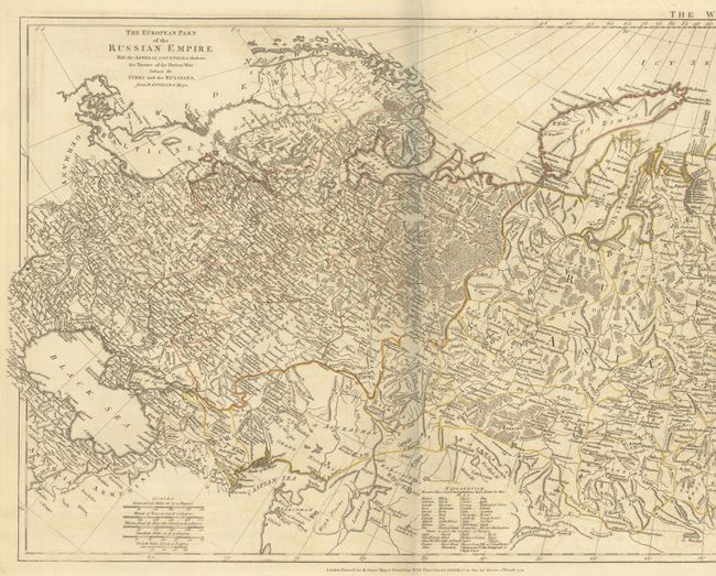
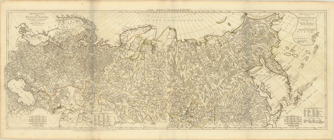
Subject: Russia
Period: 1772 (dated)
Publication: A General Atlas...
Color: Hand Color
Size:
50.5 x 18.7 inches
128.3 x 47.5 cm
This is the first edition of this great map of the Russian Empire printed on two sheets and joined, as issued. It is based upon the cartography of d'Anville with extensive detail throughout including information on the region involved in the conflict between the Turks and the Russians north of the Black Sea. The Asiatic part of the map features a superb conjectural Alaskan Peninsula and some completely spurious islands in the north Pacific. These include Company's Land and Kia-ytho of Chinese and Japanese Probably the same with the Land of Juan de Gama. Laurie and Whittle succeeded Sayer in 1794 and reissued many of his maps including this one, which was updated with information from the Imperial Academy at St. Petersburg and from Capt. Cook's exploration of Kamchatka.
References: Shirley (BL Atlases) T.SAY-2a #21.
Condition: B+
A crisp impression with contemporary outline color on sturdy paper with Strasbourg Lily watermarks. There is light offsetting.