Subject: Eastern Europe & Baltic
Period: 1790 (circa)
Publication:
Color: Hand Color
Size:
10.2 x 7.8 inches
25.9 x 19.8 cm
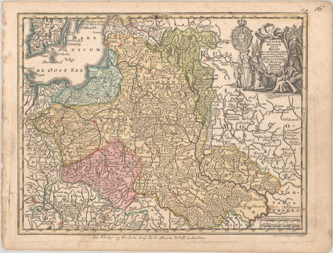
This small, handsome map of the region spans from the Baltic through northern Hungary and Romania. It is densely engraved with topographical information and place names. The top right corner is decorated with a figurative title cartouche and a coat of arms. Engraved by Tobias Conrad Lotter. The imprint at bottom, "Im Verlag zu haben bey Ioh. Mart. Will. in Augsburg," indicates that this is a later edition, after Johann Martin Will and Johannes Walch purchased the rights to the Lotter maps in 1789.
References: cf. Shirley (BL Atlases) T.SEU-3a #61.
Condition: B+
A nice impression with full contemporary color. There are a couple of small stains, light soiling around map edges, and a short archivally repaired edge tear confined to the right blank margin.