Subject: Eastern Europe, Poland
Period: 1717 (dated)
Publication: L'Atlas Curieux ou le Monde...
Color: Black & White
Size:
12.5 x 8.7 inches
31.8 x 22.1 cm
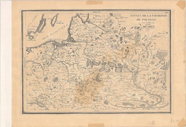
This handsome French map covers the region between the Baltic and Moscow. It spans as far north as the Golfe de Livonia (Gulf of Riga) and as far south as the Black Sea's northern shore, centering on the marshlands of present-day Belarus. Several cities are identified, including Vienna, Gdansk, Poznan, Krakow, Warsaw, Vilnius, Riga, Leopol (Lviv), Kyiv, Hrodna, Smolensk, and Belgorod. The islands of Bornholm, Oland, and Gotland are located in the Baltic.
References: Pastoureau, FER I D.
Condition: B
On a lightly toned watermarked sheet with light staining in the middle of map image. The left margin is reinforced with binding tape, and there are light tape stains in the blank margins.