Subject: Southeastern Austria & Northern Croatia
Period: 1720 (circa)
Publication:
Color: Hand Color
Size:
22.3 x 19 inches
56.6 x 48.3 cm
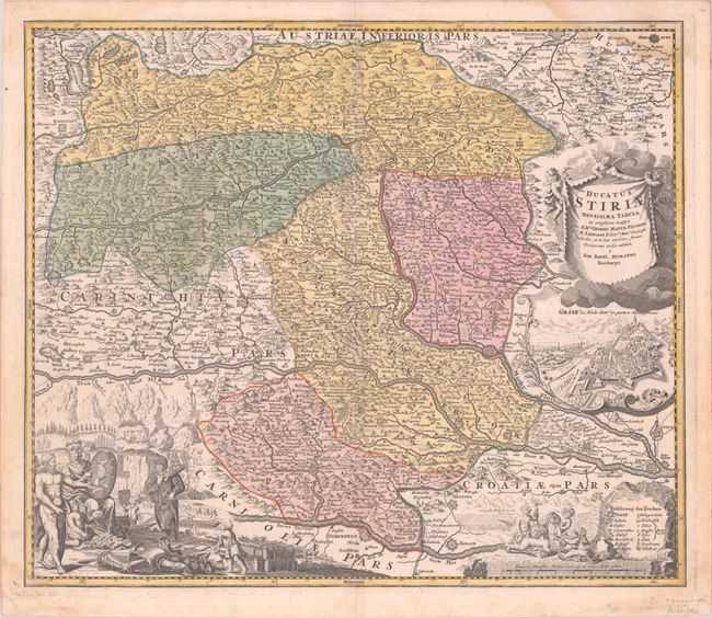
This map follows the course of the Mur River through southeastern Austria to Legrad, Croatia and includes parts of northern Croatia and a bit of northeastern Slovenia. Large cities are depicted as fortified plans, including Zagreb, Graz, Wiener Neustadt, and Klagenfurt am Worthersee. Early roads, political boundaries, vineyards, and mines for silver, copper, iron and salt are also shown. Three putti hold aloft a drape-style title cartouche, below which is a bird's-eye view of Graz. At bottom left is a large vignette depicting the important mining industry in the region.
References:
Condition: B+
A nice impression with full contemporary color on a bright sheet with light dampstains entering the corners of the map.