Subject: Heidelberg, Germany
Period: 1552 (published)
Publication: La Cosmographie Universelle
Color: Hand Color
Size:
28 x 10.1 inches
71.1 x 25.7 cm
Sebastian Munster (1489 - 1552) was one of the three most renowned cartographers of the sixteenth century, along with Mercator and Ortelius. Munster's Geographia and Cosmographia Universalis were two of the most widely read and influential books of the period. His editions of Ptolemy's Geographia, published between 1540 and 1552, were illustrated with 48 woodcut maps, the standard 27 Ptolemaic maps supplemented by 21 new maps. These new maps included a separate map of each of the known continents and marked the development of regional cartography in Central Europe. The antique geography was a prelude to Munster's major work, the Cosmographia, which was published in nearly 30 editions in six languages between 1544 and 1578 and then was revised and reissued by Sebastian Petri from 1588 to 1628. The Cosmographia was a geographical as well as historical and ethnographic description of the world. It contained the maps from the Geographia plus additional regional maps and city views with nearly 500 illustrations which made it one of the most popular pictorial encyclopedias of the sixteen century.
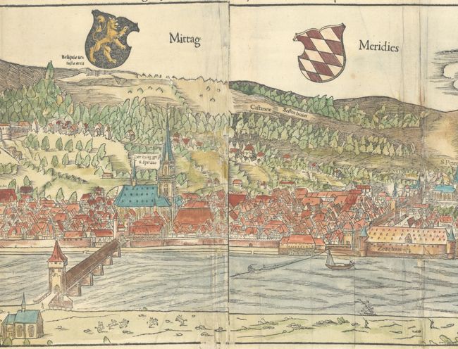
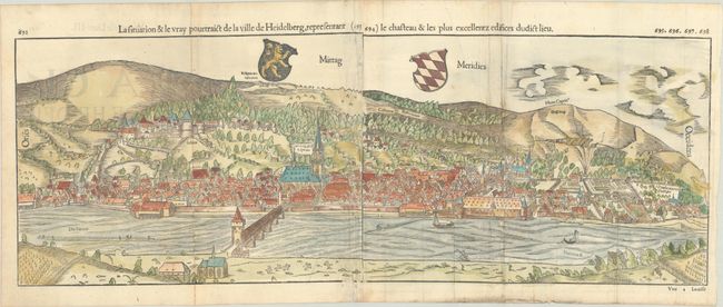
Superb woodblock panorama of Heidelberg showing the city with its magnificent cathedrals and hilltop castle. In the foreground flows the Neckar River spanned by a covered bridge. Two coats of arms float above the city, including an inverse image of Heidelberg's arms at left. This is a rare, early view of the city consisting of two joined sheets. Because of its size, it was issued folded into the binding, and therefore most are found severely damaged or missing part of the view.
References: Shirley (BL Atlases) T.MUN-1d #78.
Condition: B+
A nice impression, issued folding on bright sheets with minor soiling and some mis-folding along two folds. There is a small chip in the bottom margin, and the bottom edge of the sheet has been reinforced with old paper on verso.