Subject: Central Germany
Period: 1659 (circa)
Publication:
Color: Hand Color
Size:
22.1 x 17.7 inches
56.1 x 45 cm
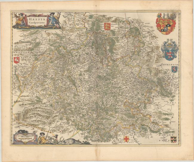
This decorative map of the Hesse-Kassel region, filled with scores of villages, forests, mountains and rivers, is centered on Kassel and shows a large amount of detail on a scale of about one German mile per inch. The Anderloon Forest is to the southwest and Thuringia is to the east. Both the title cartouche and scale of miles are decorated with elaborate hunting scenes, and the map is further embellished with seven coats-of-arms of the various regions. Spanish text on verso, published between 1659-70.
References: Van der Krogt (Vol. II) #2450:2B.
Condition: A
A dark impression with full contemporary color on a sheet with a large watermark of the god Atlas. There is a bit of printer's ink residue, light toning that is confined to the bottom centerfold, and marginal soiling.