Subject: Western Germany
Period: 1670 (circa)
Publication:
Color: Hand Color
Size:
20 x 15 inches
50.8 x 38.1 cm
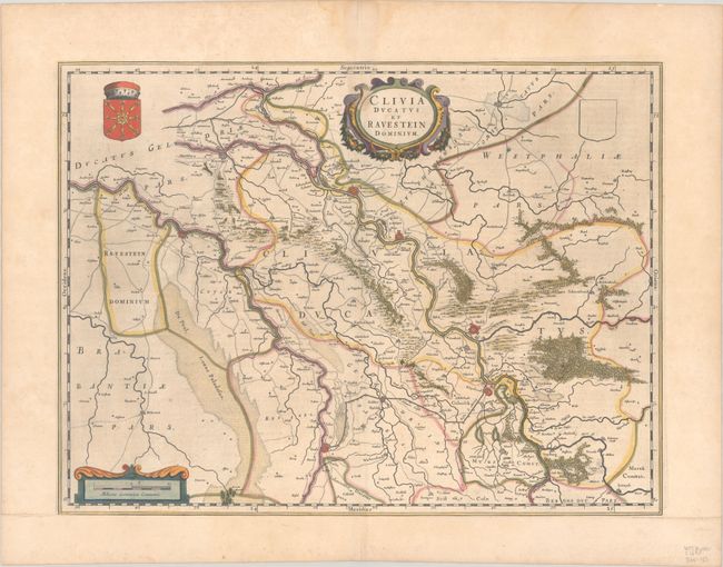
western North Rhine Westphalia; Handsome map of the Duchy of Cleves in part of North Rhine-Westphalia along the border with The Netherlands. Includes Nijmegen, Emmerich, Wesel and Venlo and shows roads, fortified cities, forests, marshes, rivers, bridges, etc. Embellished with decorative title and distance scale cartouches and the coat of arms of Cleves. German text on verso.
References: Van der Krogt (Vol. II) #2370:2.
Condition: B+
A dark impression with full contemporary color on a lightly toned sheet. There is a light dampstain that enters the image at top center, and the sheet has been professionally remargined at bottom with period-correct paper.