Subject: Cartographic Miscellany, Puzzle Map, United States
Period: 1854 (dated)
Publication:
Color: Hand Color
Size:
17.3 x 10.3 inches
43.9 x 26.2 cm
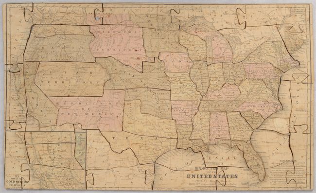
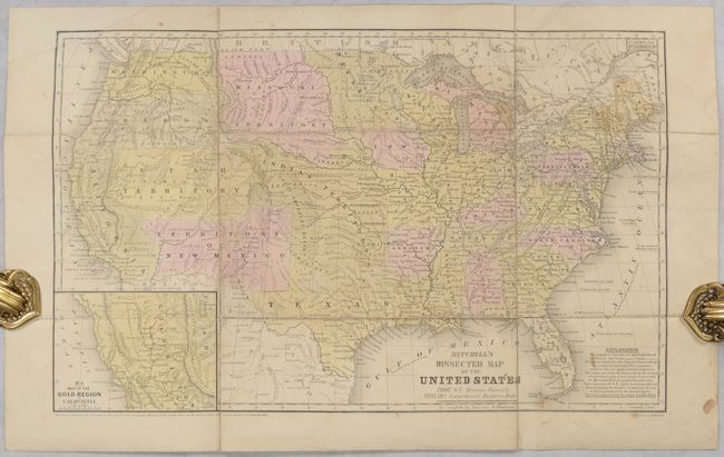
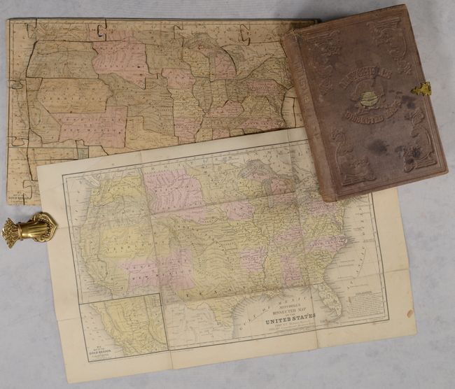
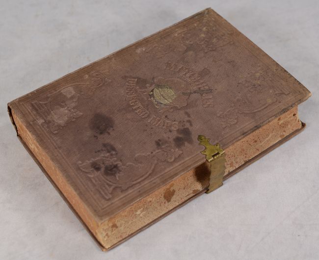
This early puzzle map of the United States is complete with its original guide map and box. The puzzle is based upon Mitchell's No. 5 Map of the United States...(1852) that was issued in Mitchell's School and Family Geography. Cartographically, it features transitional western borders including the important territorial acquisitions of the Mexican-American War. Oregon and Washington extend to the Continental Divide, the huge Missouri Territory rests between the Continental Divide and Minnesota, and both Utah and New Mexico are in their largest configurations. The inset map "No. 6 Map of the Gold Region of California" delineates the Gold Regions, naming Sutter's Buttes, Sacramento City, and all of the important creeks of the gold region feeding into the Sacramento and Feather Rivers. The puzzle consists of 54 pieces and, given their irregular shapes, putting it together is no easy task. The original box is constructed of paper over carved wood to simulate a book and is cloth covered with embossed gilt titling on front cover and spine. The box is complete with its original brass closure mechanism that is in good working condition. Inside the cover, the original paper label explains the puzzle and lists others for sale. Published by Merriam, Moore & Co. in Troy, N.Y. A rare, early American puzzle map. We found only one past listing for this puzzle in the last 40 years.
References:
Condition: B
The puzzle is good with light foxing and staining. A few pieces have small repairs, the top left corner piece is slightly warped, and there is a tiny chip to a connecting piece at top. The folding guide map has been backed with tissue to reinforce and repair numerous fold separations. The top left corner of the guide map has also been replaced in facsimile. The box, remarkably intact, is stained and sunned.