Subject: Southeastern Netherlands & Western Germany
Period: 1691 (circa)
Publication:
Color: Hand Color
Size:
21.4 x 18.3 inches
54.4 x 46.5 cm
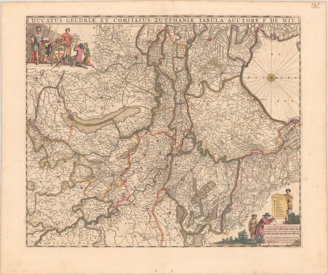
This intricately engraved map covers the area to the southeast of the Zuiderzee, including the Dutch provinces of Gelderland and Utrecht and a portion of western Germany. Several towns and cities are identified, including Arnhem, Dusseldorf, Amersfoort, and Nijmegen. There is excellent detail of the many rivers, roads, marshes, and more that run through the region. Two decorative cartouches adorn the map: one at top left with armorial shields and allegorical figures, and the other featuring four inquisitive young men, the distance scale, and a key that identifies cities, villages, watermills, and more. North oriented to the right. This is the fifth state of the map with swamps added in Comitatus Zutphania (bottom right).
References: Carhart #119.5
Condition: B+
A crisp impression with full contemporary color. There is some light color offsetting and several small cracks due to oxidation of the green pigment that have been closed on verso with archival tape.